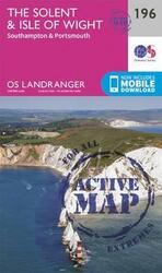
The Solent & the Isle of Wight, Southampton & Portsmouth, Sheet Map, By: Ordnance Survey
- Extra 10% OFF - Use Code RAINRECOVERY
- View Offer Details

zoom_in Click to zoom
The Solent & the Isle of Wight, Southampton & Portsmouth, Sheet Map, By: Ordnance Survey
AED97.00
Inclusive of VAT
AED105.43
8% Off
Inclusive of VAT
To be delivered within 3 business days

Shipping/Delivery
3Free Shipping
Payment Option
Cash-on-delivery

Return Policy
30 day returns. Buyer pays for return shipping. Terms & conditions apply.
Product Description
The OS Landranger Active Map series covers Great Britain with 204 detailed maps, perfect for day trips and short breaks. Tough, durable and weatherproof, covered in a lightweight protective plastic coating that can be written on, so that your favourite routes can be easily highlighted. Each map provides all the information you need to get to know your local area and includes places of interest, tourist information, picnic areas and camp sites, plus Rights of Way information for England and Wales. OS Landranger Active now includes a digital version of the paper map, accessed through the OS smartphone app, OS Maps.
Specifications
- Books Author: Ordnance Survey
- Language: English
- Publisher: Ordnance Survey
- Books Category: Travel
- Book Format: Calendars, Maps & Posters
- Books_ISBN: 0319475190
- Other Feature 1: Edition: February 2016 ed
- Other Feature 2: Weight: 161 grams
- Other Feature 3: Size: 137 x 228 x 22 mm
- Publication Date: February 24, 2016