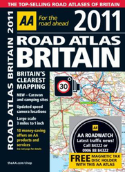
AA Road Atlas Britain 2011, Spiral Bound, By: AA Publishing
- Extra 10% OFF - Use Code RAINRECOVERY
- تفاصيل العروض

zoom_in اضغط للتكبير
AA Road Atlas Britain 2011, Spiral Bound, By: AA Publishing
AED 72.55
شاملا ضريبة القيمة المضافة
AED 78.86
8% خصم
شاملا ضريبة القيمة المضافة
سيتم التوصيل خلال 3 أيام عمل

الشحن والتوصيل
3التوصيل مجاني
Payment Option
Cash-on-delivery

سياسة الاستبدال
30 day returns. Buyer pays for return shipping. الشروط والأحكام apply.
وصف المنتج
This top-selling road atlas showcases Britain's clearest mapping at 3.2 miles to 1 inch, from the experts at the AA. Given away with this atlas is a free magnetic tax disc holder and 10 money saving vouchers offering great discounts on AA products and services. Each page has been titled with its geographical location so you can turn to the page you need more easily. Static speed camera locations with speed limits are pinpointed. Wide minor roads, National Trust, English and World Heritage, crematorium locations and other hard-to-fi nd places are also shown. There are 100 city, town and port plans, full-colour county, unitary and administrative area map and a comprehensive 31, 500 entry index with airports, top tourist sites and motorway services listed. Plus, scenic routes, tourist sites with satnav friendly postcodes and caravan and camping sites symbolised on the mapping. The paper in this atlas is produced from environmentally sustainable resources.
المواصفات
- Books Author: AA Publishing
- Number Of Pages: 328
- Language: English
- Publisher: Aa Publishing
- Books Category: السياحة و السفر
- Book Format: Spiral Bound
- Books_ISBN: 0749566221
- Other Feature 1: Edition: 25th Revised edition
- Other Feature 2: Weight: 1,238.31 grams
- Other Feature 3: Size: 216 x 297 x 22.86 mm
- Publication Date: September 01, 2010